If you become interested in seeing older satellite images of an area here’s how to do it. Do note that depending on the area/location is how far back and how many archived dates there are. Large cities have heaps, whilst regional areas not so much. USA also has so much more than Australia etc.
The first step is to download Google Earth from here, choose your operating system (PC or Mac), agree to the terms and install the program.
Open up Google Earth (may be called Google Earth pro) and navigate or search in the top left the area you want to see archived satellite images of.
Now in the top bar click the icon that is a clock with a green arrow going part way around it:

You will now see a gauge appear with arrows at each end, this is to change the dates back and forth in between the archives images. Or you can click the lines in the bar to skip ahead. Furthermost to the left is the oldest archived satellite map.
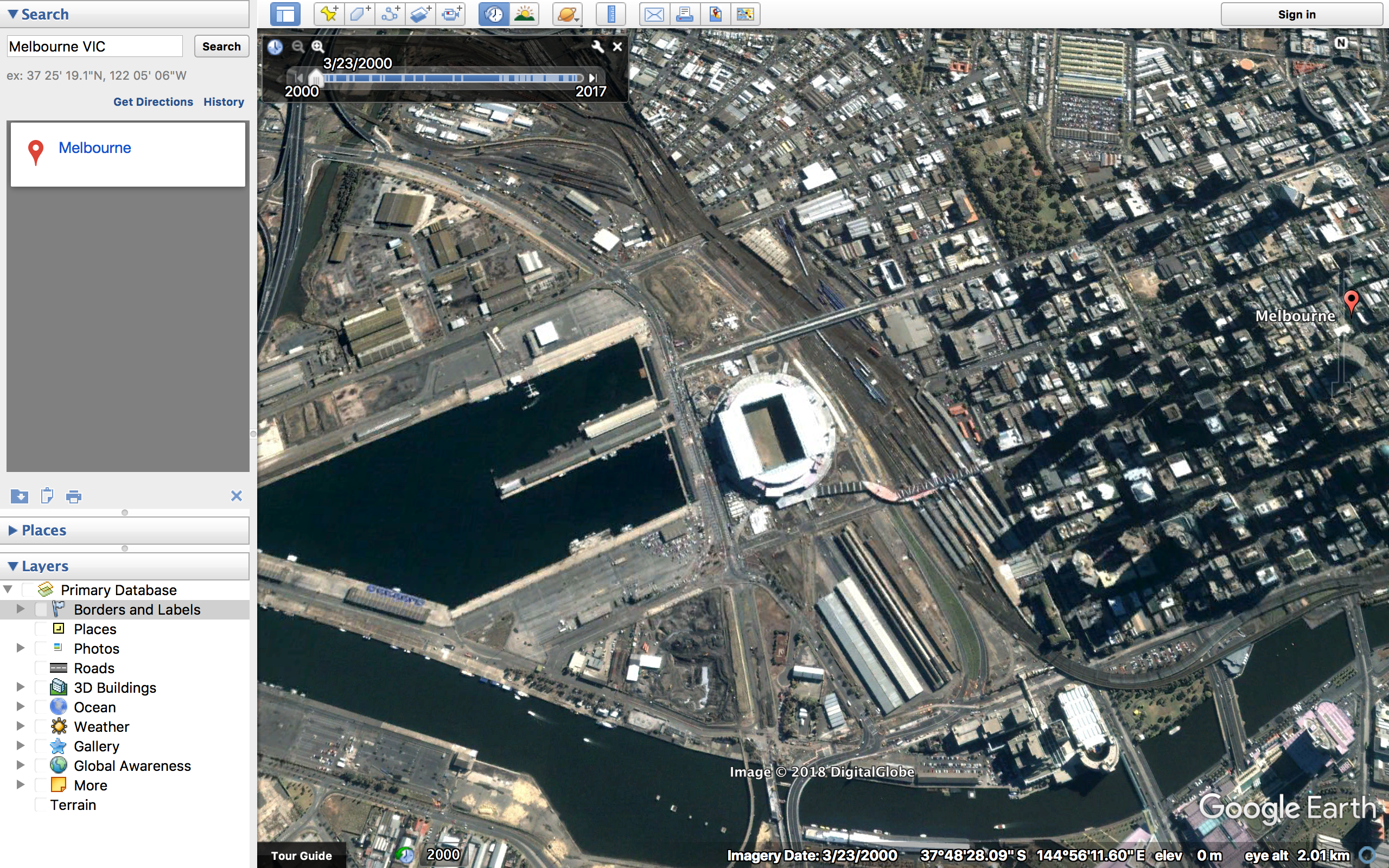
Here in the image above you can see I have viewed the oldest archived map from the docklands area in Melbourne, which is the 23/3/2000.
Thats how to view old satellite map records with Google Earth, I researched a lot and tried many methods to achieve this with Google Maps but nothing worked. But Google Earths is easy to get, free and as you now see can provide archived and older satellite images and maps.